


Topoqraf AZ — land surveying and topography company in Baku
Geodetic support at every stage of your project
'Topograph' company carries out measurement work on objects of any complexity. We use laser scanners and high-precision electronic total stations to create site plans and elevations. The service is often ordered by organizations specializing in construction and design. Based on the results of the measurements, cost estimates are prepared, and projects for reconstruction, extensions, and facade cladding replacement are developed. If the construction process is expected to resume after a long pause, the geometric parameters of the unfinished structures must also be clarified through geodetic measurements.
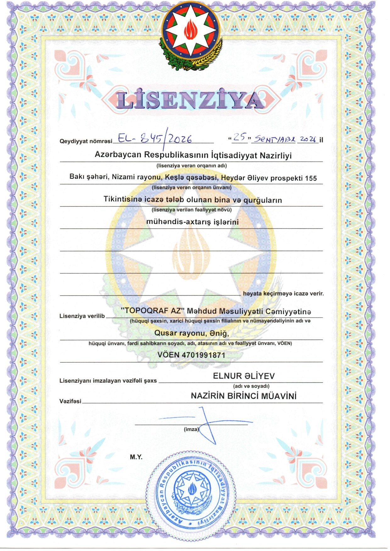
"TOPOQRAF AZ" LLC carries out engineering surveys under state license EL-845/2026 and is the official distributor of SOUTH surveying equipment in Azerbaijan.
Our experience in numbers
Every figure reflects our quality and precision.
- 1500+ Completed projects Covering industry, infrastructure and cadastre.
- 5+ Years of experience Know-how tested in the toughest field conditions.
- 80 Buildings scanned Buildings, facades and industrial facilities digitised with 3D laser scanners to millimetre accuracy.
- 50+ Sites larger than 10,000 m² Scan to BIM information models delivered for large industrial and public facilities.
Our areas of work
What you get as a result
Technical report
Methods, accuracy assessment and results — ready for review and for the client.
Graphic materials
Topographic plans, sections, schemes and drawings in DWG and PDF.
Digital model
Digital terrain model, point cloud or BIM model — loads straight into design software.
Design recommendations
Conclusions and recommendations on soils, groundwater and site conditions for designers.
How we work
- 1
Terms of reference
We clarify the site, purpose and required accuracy, then prepare a work programme and quote.
- 2
Field work
We survey the site with GNSS RTK, total stations, levels, laser scanners and drilling rigs.
- 3
Laboratory and office processing
We process the measurements and test soil samples in the lab.
- 4
Report preparation
We prepare plans, models and the technical report to current standards.
- 5
Handover and support
We hand over the materials and answer questions during review and design.
State-licensed engineering surveys
"TOPOQRAF AZ" LLC performs engineering surveys for buildings and structures that require a construction permit, under a license issued by the Ministry of Economy of the Republic of Azerbaijan.
- Registration number
- EL-845/2026
- Date of issue
- 25.09.2026
- Issuing authority
- Ministry of Economy of the Republic of Azerbaijan
- Tax ID (VÖEN)
- 4701991871
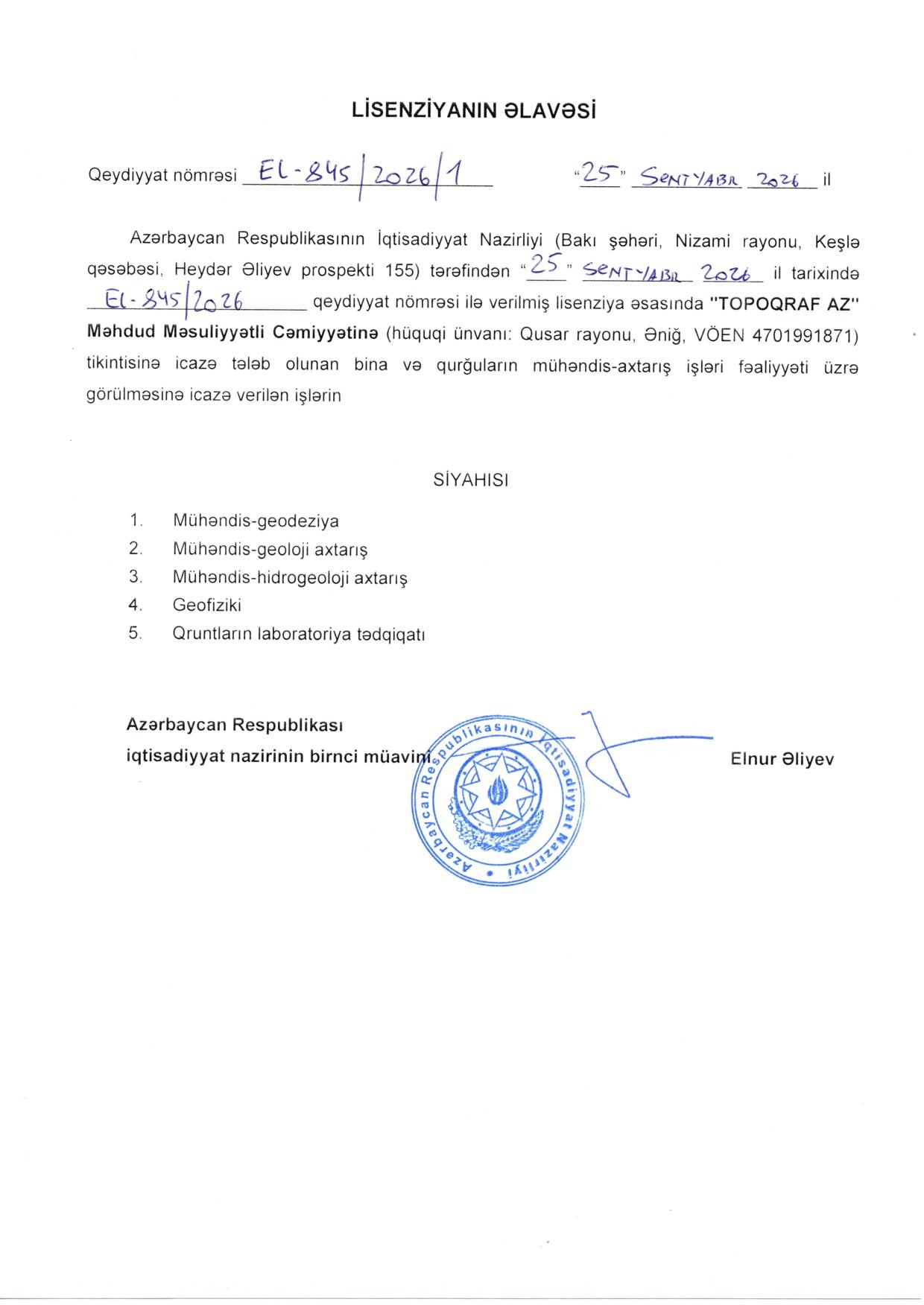
Licensed activities
Our equipment
 Official distributor in Azerbaijan

GNSS RTK receivers
Real-time positioning in the field with ±1–2 cm accuracy.
SOUTH INNO7
Total stations
Angle and distance measurement, setting-out and as-built surveys.
SOUTH A1 1", A1 2", A1X 1", A1X 2"
Digital levels
Millimetre-accurate levelling and settlement monitoring.
SOUTH DL-202
3D laser scanners
Point-cloud surveys of buildings and industrial plants.
SOUTH SPL-1500/SPL-620/SPL-370/SPL-180Why Topoqraf AZ
State license
License EL-845/2026 covers geodetic, geological, hydrogeological, geophysical surveys and lab testing.
Our own equipment
As the official SOUTH distributor we work with modern GNSS, total stations, levels and laser scanners.
One-stop approach
Topography, geology, lab and 3D scanning in one company — saving time and cost.
Accuracy
Control measurements at every stage; results are checked against standard accuracy requirements.
On-time delivery
The schedule is agreed in advance; urgent orders are accepted too.
Across Azerbaijan
Besides Baku and Absheron, we work in the regions too.
Partners and clients
Official partnerships with international manufacturers and long-term cooperation with clients in construction, industry and infrastructure.
Reference projects


Measurement work is also required in the following cases

Project documents are lost;
The value of real estate is being assessed;
Equipment purchase is planned for buildings within the structure;
The load-bearing capacity of building structures is checked.
In addition, measurements help ensure the full completion of construction work. Measurements are also carried out after accidents to identify all defects and assess damage to the building. Based on the inspection results, conclusions are drawn about the feasibility of further use of the facility, and a restoration plan is developed.

Building measurements
This type of measurement work is the most extensive. Laser scanners or high-precision electronic total stations are used to speed up the process. In small buildings, measurements are carried out using geodetic methods.
Measurement of structures
During inspections of bridges, tunnels, overpasses, and other structures, the length of spans and the height and cross-section of columns are measured. Special attention is paid to support joints. The verticality and horizontality of elements and their compliance with the specified slopes are checked. Measurement drawings show heights in longitudinal and cross-sections.
The client receives

3D model of the building;
Plans of all floors, including basement, terrace, attic, and technical floor;
Foundation plan;
Arrangement of floor slabs;
Facade views from all sides around the perimeter;
Roof plan including ventilation ducts, electrical lines, and other elements;
Longitudinal and cross-sections.
In most cases, the actual geometric parameters of the object do not match the design. In such cases, builders, repair teams, designers, and architects need the most accurate data. To obtain this information, measurement work should be ordered from a specialized organization.
Frequently asked questions
What license does Topoqraf AZ hold?
"TOPOQRAF AZ" LLC holds license EL-845/2026 of 25.09.2026 issued by the Ministry of Economy of Azerbaijan for engineering geodetic, geological, hydrogeological and geophysical surveys and laboratory soil testing.
Who is a topographic surveyor and what do they do?
A topographic surveyor measures terrain, buildings, roads and utilities and produces topographic plans and maps. The plan is the key document for design, building permits and earthworks.
What is geodesy?
Geodesy is the science and engineering of measuring the Earth's surface and determining coordinates and heights of objects. Setting out axes, as-built surveys and deformation monitoring in construction are geodetic works.
What equipment do you use?
GNSS RTK receivers, electronic and robotic total stations, digital levels, 3D laser scanners and geological drilling rigs. The company is the official SOUTH distributor in Azerbaijan.
Where do you work?
Our office is in Baku (15 Fazail Bayramov St). We work in Baku, Sumgait, Absheron and all regions of Azerbaijan.



