

Topoqraf.az AutoCAD plugin: coming soon

The Topoqraf.az team is building its own AutoCAD plugin for the surveying and topography work we have been doing in the field and in the office for years. The goal is simple: one menu for the daily work from field measurements to a finished drawing, with less manual routine.
The plugin is in internal testing and will be presented on 1 December 2026. Here is a short look at what we are preparing.
What is in the package
- Coordinates and surveying: point import and export, a point database, WGS 84 and every UTM zone, coordinate transformations.
- Terrain and topography: surfaces (TIN), contours, topographic symbols, an object classifier.
- As-built drawings: design against measured values, deviations over tolerance highlighted, a deviation table.
- Earthworks: volumes and grading.
- Roads, profiles and cross-sections.
- Architecture and site plans: walls, doors and windows, rooms, utility networks.
- Everyday CAD tools: text and tables, layers, blocks, sheets, scale and dimension system.
In all, more than 700 commands in 18 groups, collected on the AutoCAD ribbon in two tabs. The plugin works in four languages: Azerbaijani, Russian, English and Turkish.
As-built: design and actual side by side
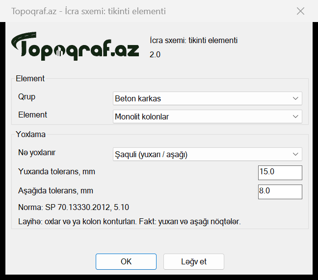
As-built drawings are the plugin's strongest part. It has a catalogue of construction elements, from foundations and columns to pipelines. Pick an element and the check type and tolerance fill in by themselves, with the reference standard shown in the window. You can change the value to fit your project.
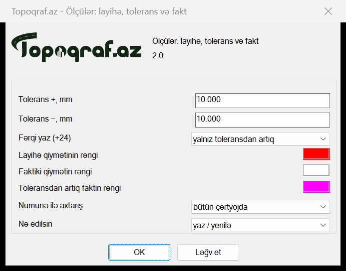
Dimensions show the design value with its tolerance above the line and the actual value below it. Deviations over tolerance get their own colour, for the whole drawing at once. The automatic as-built tool reads design and survey data from layers and calculates the deviations itself.
TopoEarth: KML and KMZ straight into AutoCAD
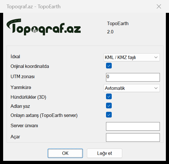
Google Earth files (KML/KMZ) are imported in their original coordinates. The UTM zone and hemisphere are detected automatically, and elevations and object names are kept. WGS 84 and UTM come first; local systems stay as an extra option.
When?
The plugin will be presented on 1 December 2026. Follow the news here and on our social media.



