What Is Topography? Topographic Surveys in Baku
Topography measures the terrain, buildings, roads, utilities and other features of an area and shows them on scaled plans and maps.
Licensed service · EL-845/2026What is topography?
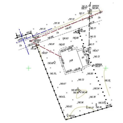
Topography measures the terrain and the features on it — buildings, roads, fences, trees, underground and overground utilities — and shows them to scale on plans and maps. It is part of geodesy, and its result is a topographic plan or map.
Topographic plan vs topographic map
A topographic plan shows a small area at a large scale (usually 1:500 – 1:2000) and is required for design, building permits, land division and utility works. A topographic map covers larger areas at smaller scales and is used for planning, terrain analysis and GIS.
How a topographic survey is done
- Preparation: purpose, scale and boundaries are defined.
- Field work: terrain, features and utilities are measured with GNSS RTK receivers and total stations; drones and laser scanners are used on large sites.
- Office work: data are processed, contours generated and the plan drawn in AutoCAD (DWG/DXF).
- Delivery: digital and printed plans, in the national coordinate system if required.
Price
The price depends on the area, scale, density of buildings and utilities and the location. Send us the site address and we will calculate it. Topoqraf AZ carries out topographic and geodetic works under state licence EL-845/2026 in Baku and all regions.